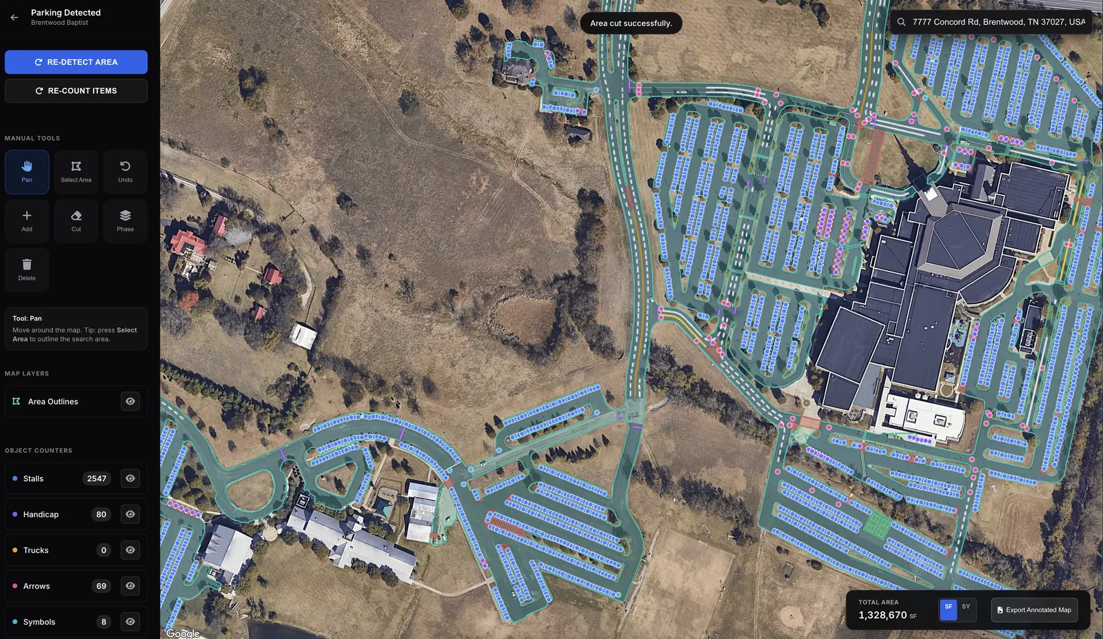
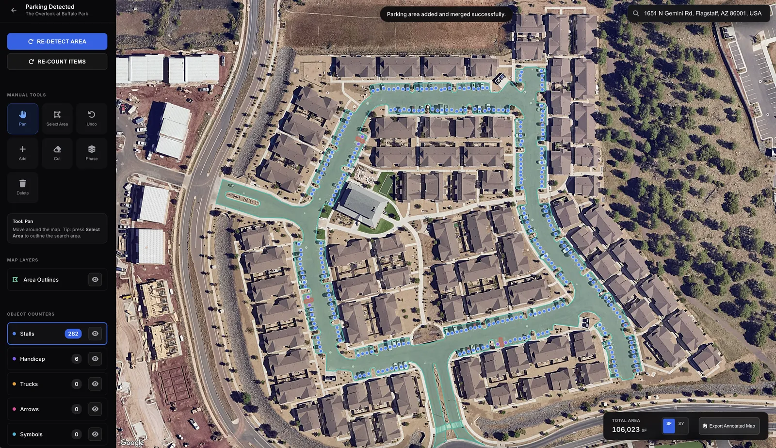
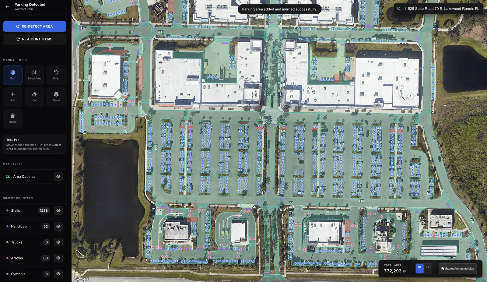
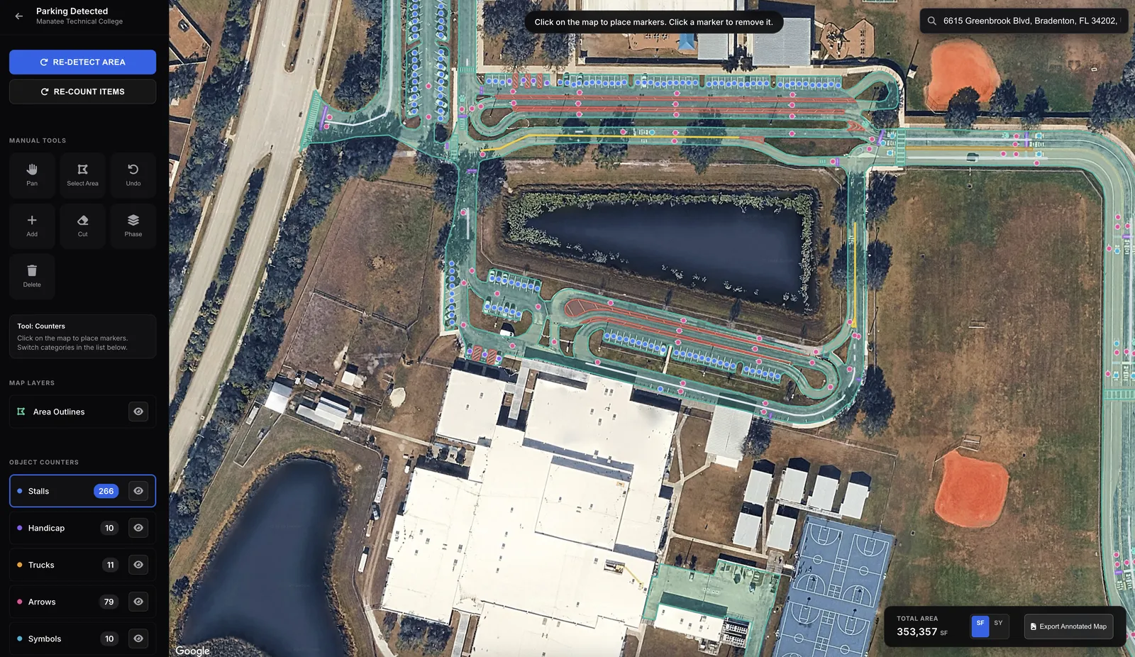
Paving estimates in seconds.
Square footage, stall counts, and striping. Book a demo to get access.
Built by computer vision experts from


Backed by DoorDash's early investors

Built for every site
Want a walkthrough?
Book a quick call and we'll set everything up for you.
Snap a photo. We handle the rest.
Your crew takes site photos. TruTec automatically detects damage, writes captions, and builds client-ready reports.
Bounding boxes around cracks, potholes, and faded striping in seconds.
Set up your tags once and captions write themselves for every photo.
Arrows, text, and real-world measurements from LiDAR when available.
Every photo pinned to the map. Before / During / After organized automatically.
The office sees photos and map pins the moment your crew uploads — no waiting, no syncing.
Send a link. See when your client views it so you know when to follow up.
Bill it. Track it. Get paid.
Turn any estimate into an invoice — deposit, milestone, or full — copy the payment link, and text it to your client. Money hits your bank account. No chasing.
One click on a finished takeoff. Pick full, deposit, milestone, line items, or recurring — the invoice builds itself.
Every invoice gets a Stripe payment link. Text it, email it, hand it over on-site — client pays online in seconds.
Customers, estimates, invoices, and payments push to QuickBooks the moment they happen. Zero double-entry.
Connect your bank once. Every payment lands in your account — no checks, no processing delays.
Real-time tracking shows the second a client opens your proposal or views your invoice — follow up at exactly the right time.
Blueprint takeoffs, automated
Upload a PDF. We read the legend, identify objects, and return measurements in seconds.
Want parking lot measurements now? Book a demo
See what you're leaving on the table.
Get in Touch
Have questions? We'd love to hear from you. Reach out and our team will get back to you promptly.
Frequently asked questions
Built by computer vision experts from
Backed by DoorDash's early investors